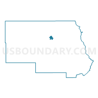
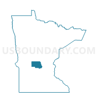
Albany Voting District, Stearns County, Minnesota
About
Outline

Summary
| Unique Area Identifier | 604437 |
| Name | Albany Voting District |
| County | Stearns County |
| State | Minnesota |
| Area (square miles) | 2.22 |
| Land Area (square miles) | 2.11 |
| Water Area (square miles) | 0.11 |
| % of Land Area | 95.02 |
| % of Water Area | 4.98 |
| Latitude of the Internal Point | 45.62666820 |
| Longtitude of the Internal Point | -94.56340270 |
Maps

Graphs
Select a template below for downloading or customizing gragh for Albany Voting District, Stearns County, Minnesota